 vesseltracker.com
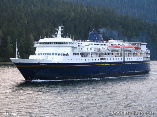
Vessel Kennicott IMO: 9145205, MMSI: 368250000 Passenger Ro Ro Cargo Ship
UTC, 57.25919, -135.57812, course: 327, speed: 16.3
UTC, 57.55850, -135.48778, course: 19, speed: 17
2026-03-24 19:53:56 UTC, 57.16985, -134.70174, course: 164, speed: 17.9
Live Vessel Kennicott Analytics (details, animations, etc.)
Live AIS position: UTC. Near Tyee), updated 2026-03-24 19:53:56 UTC.Find the position of the vessel Kennicott on the map. The latter are known coordinates and path.
marine traffic ship tracker show on live map
The current position of vessel Kennicott is 57.16985 lat / -134.70174 lng. Updated: 2026-03-24 19:53:56 UTCDetails:
Last coordinates of the vessel:
UTC, 57.12951, -135.38264, course: 267, speed: 0UTC, 57.25919, -135.57812, course: 327, speed: 16.3
UTC, 57.55850, -135.48778, course: 19, speed: 17
2026-03-24 19:53:56 UTC, 57.16985, -134.70174, course: 164, speed: 17.9