 vesseltracker.com
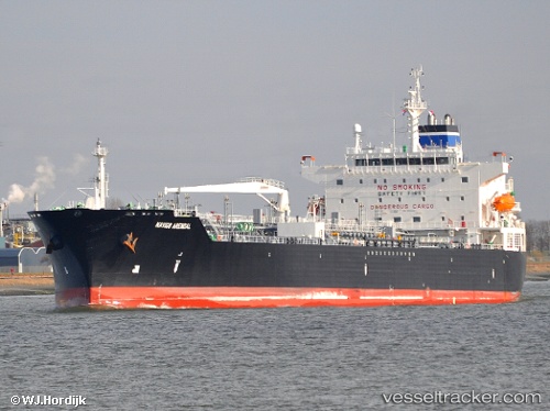
Vessel Arendal IMO: 9516222, MMSI: 370297000 Chemical Oil Products Tanker
UTC, 51.52855, 1.49440, course: 127, speed: 0.3
UTC, 51.52798, 1.49412, course: 106, speed: 0
2026-02-13 13:57:16 UTC, 51.52647, 1.49507, course: 31, speed: 0.5
Live AIS position:
UTC. Near Milton, Abingdon),
updated 2026-02-13 13:57:16 UTC.
Find the position of the vessel Arendal on the map. The latter are known coordinates and path.
marine traffic ship tracker show on live map
The current position of vessel Arendal is 51.52647 lat / 1.49507 lng. Updated: 2026-02-13 13:57:16 UTCCurrently sailing under the flag of Panama
Arendal built in 2010 year
Deadweight:
50543 tDetails:
Last coordinates of the vessel:
UTC, 51.52790, 1.49517, course: 90, speed: 0.1UTC, 51.52855, 1.49440, course: 127, speed: 0.3
UTC, 51.52798, 1.49412, course: 106, speed: 0
2026-02-13 13:57:16 UTC, 51.52647, 1.49507, course: 31, speed: 0.5