 vesseltracker.com
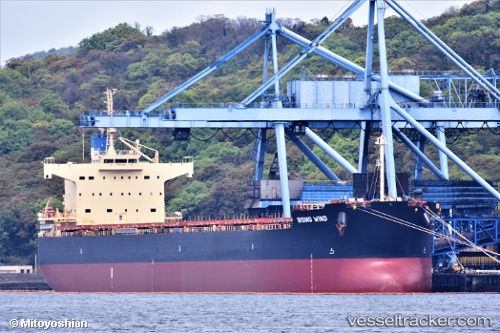
Vessel Rising Wind IMO: 9582984, MMSI: 371332000 Bulk Carrier
UTC, 0.54667, 117.69500, course: -1, speed: 0
UTC, 0.54667, 117.69500, course: -1, speed: 0
2026-02-14 13:49:50 UTC, 0.54667, 117.69500, course: -1, speed: 0
Live AIS position:
UTC. Near TANJUNG BARA),
updated 2026-02-14 13:49:50 UTC.
Find the position of the vessel Rising Wind on the map. The latter are known coordinates and path.
marine traffic ship tracker show on live map
The current position of vessel Rising Wind is 0.54667 lat / 117.69500 lng. Updated: 2026-02-14 13:49:50 UTCDetails:
Last coordinates of the vessel:
UTC, 0.54667, 117.69500, course: -1, speed: 0UTC, 0.54667, 117.69500, course: -1, speed: 0
UTC, 0.54667, 117.69500, course: -1, speed: 0
2026-02-14 13:49:50 UTC, 0.54667, 117.69500, course: -1, speed: 0