 vesseltracker.com
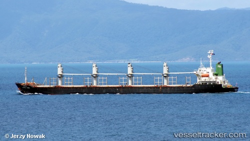
Vessel Tai Ho IMO: 9157351, MMSI: 372978000 Bulk Carrier
UTC, 31.99547, 120.57113, course: 281, speed: 0.1
UTC, 31.99552, 120.57113, course: 281, speed: 0
2026-03-10 17:29:09 UTC, 31.99550, 120.57115, course: 281, speed: 0
Live Vessel Tai Ho Analytics (details, animations, etc.)
Live AIS position: UTC. Near Zhangjiagang), updated 2026-03-10 17:29:09 UTC.Find the position of the vessel Tai Ho on the map. The latter are known coordinates and path.
marine traffic ship tracker show on live map
The current position of vessel Tai Ho is 31.99550 lat / 120.57115 lng. Updated: 2026-03-10 17:29:09 UTCDetails:
Last coordinates of the vessel:
UTC, 31.99549, 120.57112, course: 281, speed: 0.1UTC, 31.99547, 120.57113, course: 281, speed: 0.1
UTC, 31.99552, 120.57113, course: 281, speed: 0
2026-03-10 17:29:09 UTC, 31.99550, 120.57115, course: 281, speed: 0