 vesseltracker.com
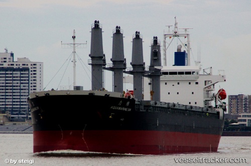
Vessel Aquamarine Sw IMO: 9597666, MMSI: 373879000 Bulk Carrier
UTC, 34.46616, -13.33207, course: 18, speed: 11.2
UTC, 34.72987, -13.22930, course: 17, speed: 11.4
2026-02-18 01:52:26 UTC, 35.18229, -13.03555, course: 16, speed: 11.5
Live AIS position:
UTC. 81 nm E of Nedroma),
updated 2026-02-18 01:52:26 UTC.
Find the position of the vessel Aquamarine Sw on the map. The latter are known coordinates and path.
marine traffic ship tracker show on live map
The current position of vessel Aquamarine Sw is 35.18229 lat / -13.03555 lng. Updated: 2026-02-18 01:52:26 UTCCurrently sailing under the flag of Panama
Aquamarine Sw built in 2012 year
Deadweight:
37119 tDetails:
Last coordinates of the vessel:
UTC, 34.23734, -13.42512, course: 18, speed: 11.3UTC, 34.46616, -13.33207, course: 18, speed: 11.2
UTC, 34.72987, -13.22930, course: 17, speed: 11.4
2026-02-18 01:52:26 UTC, 35.18229, -13.03555, course: 16, speed: 11.5