 vesseltracker.com
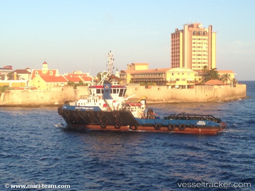
Vessel PROTUG 75 IMO: 9559781, MMSI: 376234000 Tug
UTC, 59.69801, 4.84143, course: 166, speed: 3.1
UTC, 59.55612, 4.91195, course: 138, speed: 3.6
2026-03-02 03:53:59 UTC, 59.49484, 5.06884, course: 140, speed: 4.4
Live AIS position:
UTC. Near Mølstrevåg),
updated 2026-03-02 03:53:59 UTC.
Find the position of the vessel PROTUG 75 on the map. The latter are known coordinates and path.
marine traffic ship tracker show on live map
The current position of vessel PROTUG 75 is 59.49484 lat / 5.06884 lng. Updated: 2026-03-02 03:53:59 UTCCurrently sailing under the flag of Saint Vincent and the Grenadines
Details:
Last coordinates of the vessel:
UTC, 59.76790, 4.81195, course: 170, speed: 3.4UTC, 59.69801, 4.84143, course: 166, speed: 3.1
UTC, 59.55612, 4.91195, course: 138, speed: 3.6
2026-03-02 03:53:59 UTC, 59.49484, 5.06884, course: 140, speed: 4.4