 vesseltracker.com
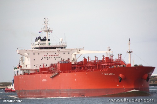
Vessel Ncc Amal IMO: 9411317, MMSI: 403513001 Oil Products Tanker
UTC, 10.87763, 64.33897, course: 112, speed: 12.7
UTC, 10.71376, 64.79207, course: 110, speed: 12.4
2026-02-16 13:30:37 UTC, 10.60226, 65.10265, course: 110, speed: 12.5
Live AIS position:
UTC. 193 nm W of Tinaquillo),
updated 2026-02-16 13:30:37 UTC.
Find the position of the vessel Ncc Amal on the map. The latter are known coordinates and path.
marine traffic ship tracker show on live map
The current position of vessel Ncc Amal is 10.60226 lat / 65.10265 lng. Updated: 2026-02-16 13:30:37 UTCCurrently sailing under the flag of Saudi Arabia
Ncc Amal built in 2011 year
Deadweight:
45544 tDetails:
Last coordinates of the vessel:
UTC, 11.01716, 64.01878, course: 106, speed: 3.4UTC, 10.87763, 64.33897, course: 112, speed: 12.7
UTC, 10.71376, 64.79207, course: 110, speed: 12.4
2026-02-16 13:30:37 UTC, 10.60226, 65.10265, course: 110, speed: 12.5