 vesseltracker.com
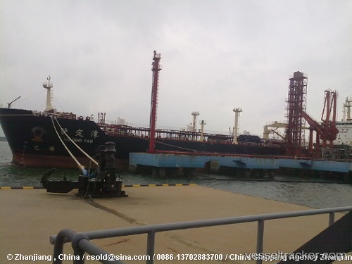
Vessel Lu Ding Tan IMO: 9344942, MMSI: 413158000 Crude Oil Tanker
UTC, 37.99536, 120.11584, course: 175, speed: 0.1
UTC, 37.99505, 120.11772, course: 218, speed: 0
2026-02-12 03:20:46 UTC, 37.99424, 120.11814, course: 236, speed: 0.1
Live AIS position:
UTC. 23 nm NW of Longkou),
updated 2026-02-12 03:20:46 UTC.
Find the position of the vessel Lu Ding Tan on the map. The latter are known coordinates and path.
marine traffic ship tracker show on live map
The current position of vessel Lu Ding Tan is 37.99424 lat / 120.11814 lng. Updated: 2026-02-12 03:20:46 UTCCurrently sailing under the flag of China
Lu Ding Tan built in 2007 year
Deadweight:
52682 tDetails:
Last coordinates of the vessel:
UTC, 37.99504, 120.11562, course: 172, speed: 0UTC, 37.99536, 120.11584, course: 175, speed: 0.1
UTC, 37.99505, 120.11772, course: 218, speed: 0
2026-02-12 03:20:46 UTC, 37.99424, 120.11814, course: 236, speed: 0.1