 vesseltracker.com
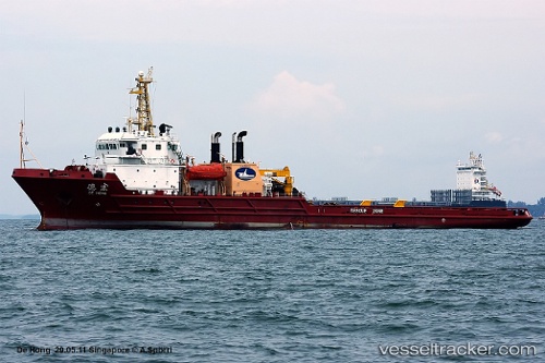
Vessel DE HONG IMO: 9191981, MMSI: 413399940 Anchor Handling Vessel
UTC, -20.16995, 59.35693, course: 229, speed: 6.4
UTC, -20.27554, 59.19580, course: 229, speed: 6.7
2026-03-24 13:51:00 UTC, -20.41044, 58.98925, course: 229, speed: 6.5
Live Vessel DE HONG Analytics (details, animations, etc.)
Live AIS position: UTC. 69 nm E of Ebene), updated 2026-03-24 13:51:00 UTC.Find the position of the vessel DE HONG on the map. The latter are known coordinates and path.
marine traffic ship tracker show on live map
The current position of vessel DE HONG is -20.41044 lat / 58.98925 lng. Updated: 2026-03-24 13:51:00 UTCCurrently sailing under the flag of China
Details:
Last coordinates of the vessel:
UTC, -20.00905, 59.59449, course: 230, speed: 6.6UTC, -20.16995, 59.35693, course: 229, speed: 6.4
UTC, -20.27554, 59.19580, course: 229, speed: 6.7
2026-03-24 13:51:00 UTC, -20.41044, 58.98925, course: 229, speed: 6.5