 vesseltracker.com
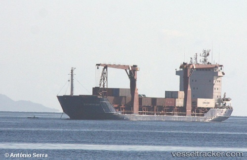
Vessel Tci Lakshmi IMO: 9143817, MMSI: 419000903 Multi Purpose Carrier
UTC, 12.62333, 83.85667, course: -1, speed: 12
UTC, 12.71333, 83.53500, course: -1, speed: 12
2026-03-01 09:41:20 UTC, 12.85134, 83.04519, course: -1, speed: 13.2
Live AIS position:
UTC. 155 nm E of Nandiambakkam),
updated 2026-03-01 09:41:20 UTC.
Find the position of the vessel Tci Lakshmi on the map. The latter are known coordinates and path.
marine traffic ship tracker show on live map
The current position of vessel Tci Lakshmi is 12.85134 lat / 83.04519 lng. Updated: 2026-03-01 09:41:20 UTCDetails:
Last coordinates of the vessel:
UTC, 12.50500, 84.27833, course: -1, speed: 12UTC, 12.62333, 83.85667, course: -1, speed: 12
UTC, 12.71333, 83.53500, course: -1, speed: 12
2026-03-01 09:41:20 UTC, 12.85134, 83.04519, course: -1, speed: 13.2