 vesseltracker.com
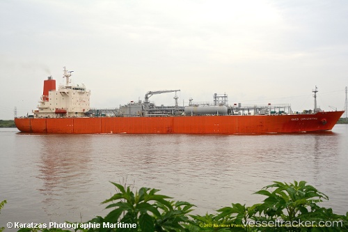
Vessel ROSE GAS IMO: 9247209, MMSI: 419001664 LPG Tanker
UTC, 19.13859, 69.43440, course: 21, speed: 0.2
UTC, 19.13859, 69.43440, course: 21, speed: 0.2
2026-03-20 05:49:47 UTC, 19.13859, 69.43440, course: 21, speed: 0.2
Live Vessel ROSE GAS Analytics (details, animations, etc.)
Live AIS position: UTC. 118 nm SW of Veraval), updated 2026-03-20 05:49:47 UTC.Find the position of the vessel ROSE GAS on the map. The latter are known coordinates and path.
marine traffic ship tracker show on live map
The current position of vessel ROSE GAS is 19.13859 lat / 69.43440 lng. Updated: 2026-03-20 05:49:47 UTCCurrently sailing under the flag of India
ROSE GAS built in 2003 year
Deadweight:
26534 tDetails:
Last coordinates of the vessel:
UTC, 19.13859, 69.43440, course: 21, speed: 0.2UTC, 19.13859, 69.43440, course: 21, speed: 0.2
UTC, 19.13859, 69.43440, course: 21, speed: 0.2
2026-03-20 05:49:47 UTC, 19.13859, 69.43440, course: 21, speed: 0.2