 vesseltracker.com
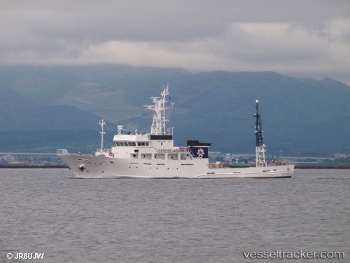
Vessel Kaiomaru IMO: 9580077, MMSI: 431000580 Fishing Support Vessel
UTC, 41.77343, 140.71159, course: 127, speed: 0
UTC, 41.77343, 140.71159, course: 127, speed: 0
2026-02-01 22:51:17 UTC, 41.77343, 140.71159, course: 127, speed: 0
Live AIS position:
UTC. Near Hakodate),
updated 2026-02-01 22:51:17 UTC.
Find the position of the vessel Kaiomaru on the map. The latter are known coordinates and path.
marine traffic ship tracker show on live map
The current position of vessel Kaiomaru is 41.77343 lat / 140.71159 lng. Updated: 2026-02-01 22:51:17 UTCDetails:
Last coordinates of the vessel:
UTC, 41.71618, 140.74692, course: 104, speed: 14.5UTC, 41.77343, 140.71159, course: 127, speed: 0
UTC, 41.77343, 140.71159, course: 127, speed: 0
2026-02-01 22:51:17 UTC, 41.77343, 140.71159, course: 127, speed: 0