 vesseltracker.com
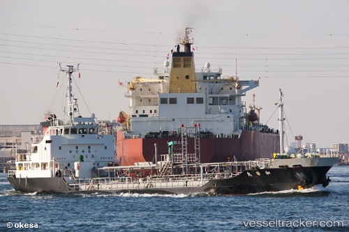
Vessel Wakamaru IMO: 9566136, MMSI: 431001387 Chemical Tanker
UTC, 35.57833, 140.06332, course: -1, speed: 0
UTC, 35.57929, 140.06483, course: 4, speed: 0.1
2026-01-16 18:55:20 UTC, 35.57929, 140.06483, course: 4, speed: 0.1
Live AIS position:
UTC. Near CHIBA),
updated 2026-01-16 18:55:20 UTC.
Find the position of the vessel Wakamaru on the map. The latter are known coordinates and path.
marine traffic ship tracker show on live map
The current position of vessel Wakamaru is 35.57929 lat / 140.06483 lng. Updated: 2026-01-16 18:55:20 UTCDetails:
Last coordinates of the vessel:
UTC, 35.57833, 140.06332, course: -1, speed: 0UTC, 35.57833, 140.06332, course: -1, speed: 0
UTC, 35.57929, 140.06483, course: 4, speed: 0.1
2026-01-16 18:55:20 UTC, 35.57929, 140.06483, course: 4, speed: 0.1