 vesseltracker.com
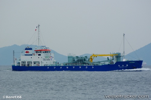
Vessel Tokusan Maru IMO: 9682162, MMSI: 431004653 Cement Carrier
UTC, 34.04483, 131.78230, course: 76, speed: 0
UTC, 34.04486, 131.78229, course: 81, speed: 0
2026-01-17 02:10:05 UTC, 34.04552, 131.78291, course: 194, speed: 0
Live AIS position:
UTC. Near Shunan),
updated 2026-01-17 02:10:05 UTC.
Find the position of the vessel Tokusan Maru on the map. The latter are known coordinates and path.
marine traffic ship tracker show on live map
The current position of vessel Tokusan Maru is 34.04552 lat / 131.78291 lng. Updated: 2026-01-17 02:10:05 UTCDetails:
Last coordinates of the vessel:
UTC, 34.04453, 131.78276, course: 359, speed: 0UTC, 34.04483, 131.78230, course: 76, speed: 0
UTC, 34.04486, 131.78229, course: 81, speed: 0
2026-01-17 02:10:05 UTC, 34.04552, 131.78291, course: 194, speed: 0