 vesseltracker.com
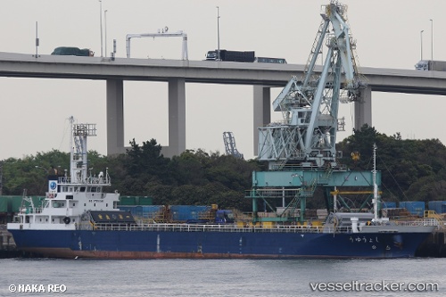
Vessel Shoyu IMO: 9780249, MMSI: 431007421 General Cargo Ship
UTC, 33.83957, 135.07581, course: 321, speed: 11.9
UTC, 34.12682, 134.77052, course: 303, speed: 11.8
2026-03-24 15:28:47 UTC, 34.36390, 134.37686, course: 297, speed: 11.9
Live Vessel Shoyu Analytics (details, animations, etc.)
Live AIS position: UTC. Near SANBONMATSU), updated 2026-03-24 15:28:47 UTC.Find the position of the vessel Shoyu on the map. The latter are known coordinates and path.
marine traffic ship tracker show on live map
The current position of vessel Shoyu is 34.36390 lat / 134.37686 lng. Updated: 2026-03-24 15:28:47 UTCDetails:
Last coordinates of the vessel:
UTC, 33.62156, 135.31934, course: 322, speed: 12.3UTC, 33.83957, 135.07581, course: 321, speed: 11.9
UTC, 34.12682, 134.77052, course: 303, speed: 11.8
2026-03-24 15:28:47 UTC, 34.36390, 134.37686, course: 297, speed: 11.9