 vesseltracker.com
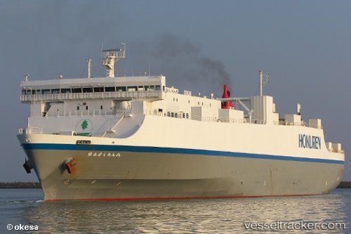
 Fuou Maru
Current Status
Where is the vessel?
Fuou Maru is currently in 18 nm S of HAMAJIMA, based on AIS data received about 1h ago.
Latest AIS update:
Current position: 34.00874° N, 136.86221° E (18 nm S of HAMAJIMA)
Average speed (last 7 days): Loading…
Average speed (last 30 days): Loading…
Vessel profile: Fuou Maru is a Vehicles Carrier with dimensions 173m x 27m.
This page combines live AIS, route history, probable destination signals, nearby traffic, and port activity for practical vessel monitoring.
The current position of vessel Fuou Maru is 34.00874 lat / 136.86221 lng. Updated: 2026-03-25 11:40:03 UTCNearest reference points:
- 20 nm S of HAMAJIMA
- 12 nm E of TOBA
- Near TOBA
Currently sailing under the flag of Japan ![]()
Details:
Live Vessel Fuou Maru Analytics (details, animations, etc.)
Recent AIS points (UTC):
2026-03-25 05:50:33 UTC · 33.81346, 135.06316 · SOG 22.7 kn · COG 142°2026-03-25 07:28:11 UTC · 33.44402, 135.59787 · SOG 22.6 kn · COG 113°
2026-03-25 09:29:56 UTC · 33.65588, 136.25690 · SOG 15.5 kn · COG 58°
2026-03-25 11:40:03 UTC · 34.00874, 136.86221 · SOG 18 kn · COG 61°