 vesseltracker.com
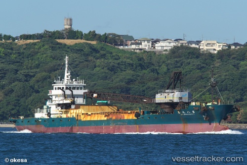
Vessel Marukimaru No8 IMO: 8974582, MMSI: 431200607 Pusher Tug
UTC, 26.59669, 127.91328, course: 232, speed: 0.1
UTC, 26.59667, 127.91356, course: 248, speed: 0.1
2026-03-24 22:04:53 UTC, 26.59643, 127.91369, course: 269, speed: 0
Live Vessel Marukimaru No8 Analytics (details, animations, etc.)
Live AIS position: UTC. Near Nago), updated 2026-03-24 22:04:53 UTC.Find the position of the vessel Marukimaru No8 on the map. The latter are known coordinates and path.
marine traffic ship tracker show on live map
The current position of vessel Marukimaru No8 is 26.59643 lat / 127.91369 lng. Updated: 2026-03-24 22:04:53 UTCDetails:
Last coordinates of the vessel:
UTC, 26.59680, 127.91312, course: 202, speed: 0.1UTC, 26.59669, 127.91328, course: 232, speed: 0.1
UTC, 26.59667, 127.91356, course: 248, speed: 0.1
2026-03-24 22:04:53 UTC, 26.59643, 127.91369, course: 269, speed: 0