 vesseltracker.com
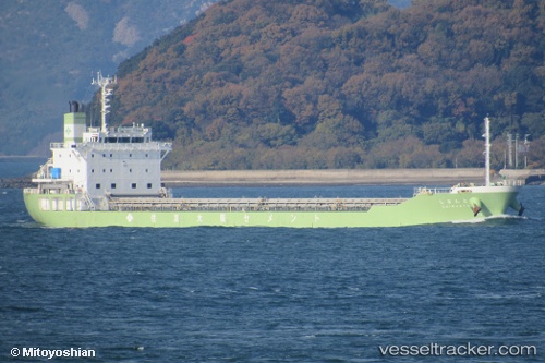
Vessel Shimanto IMO: 9234056, MMSI: 431301574 Limestone Carrier
UTC, 32.68378, 132.95770, course: 92, speed: 12.5
UTC, 33.38156, 133.28568, course: 170, speed: 6.1
2026-02-28 21:32:25 UTC, 32.81820, 133.12724, course: 199, speed: 12.1
Live AIS position:
UTC. 16 nm S of Saga),
updated 2026-02-28 21:32:25 UTC.
Find the position of the vessel Shimanto on the map. The latter are known coordinates and path.
marine traffic ship tracker show on live map
The current position of vessel Shimanto is 32.81820 lat / 133.12724 lng. Updated: 2026-02-28 21:32:25 UTCDetails:
Last coordinates of the vessel:
UTC, 32.68378, 132.95770, course: 92, speed: 12.5UTC, 32.68378, 132.95770, course: 92, speed: 12.5
UTC, 33.38156, 133.28568, course: 170, speed: 6.1
2026-02-28 21:32:25 UTC, 32.81820, 133.12724, course: 199, speed: 12.1