 vesseltracker.com
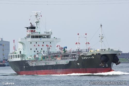
Vessel Toyo Maru No.87 IMO: 9296664, MMSI: 431401968 Chemical Oil Products Tanker
UTC, 35.49665, 140.02850, course: 215, speed: 0
UTC, 35.49670, 140.02834, course: 207, speed: 0.4
2026-02-10 05:48:27 UTC, 35.52253, 139.99440, course: 287, speed: 10.5
Live AIS position:
UTC. Near ANEGASAKI),
updated 2026-02-10 05:48:27 UTC.
Find the position of the vessel Toyo Maru No.87 on the map. The latter are known coordinates and path.
marine traffic ship tracker show on live map
The current position of vessel Toyo Maru No.87 is 35.52253 lat / 139.99440 lng. Updated: 2026-02-10 05:48:27 UTCDetails:
Last coordinates of the vessel:
UTC, 35.49672, 140.02843, course: 215, speed: 0UTC, 35.49665, 140.02850, course: 215, speed: 0
UTC, 35.49670, 140.02834, course: 207, speed: 0.4
2026-02-10 05:48:27 UTC, 35.52253, 139.99440, course: 287, speed: 10.5