 vesseltracker.com
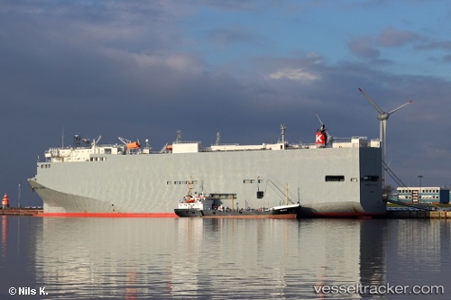
Vessel Bangkok Highway IMO: 9506710, MMSI: 431546000 Vehicles Carrier
UTC, 10.98878, 101.69837, course: 138, speed: 18
UTC, 10.98878, 101.69837, course: 138, speed: 18
2026-03-24 18:04:43 UTC, 6.52808, 103.57448, course: 177, speed: 17.7
Live Vessel Bangkok Highway Analytics (details, animations, etc.)
Live AIS position: UTC. 40 nm SW of Bunga Raya), updated 2026-03-24 18:04:43 UTC.Find the position of the vessel Bangkok Highway on the map. The latter are known coordinates and path.
marine traffic ship tracker show on live map
The current position of vessel Bangkok Highway is 6.52808 lat / 103.57448 lng. Updated: 2026-03-24 18:04:43 UTCDetails:
Last coordinates of the vessel:
UTC, 10.98878, 101.69837, course: 138, speed: 18UTC, 10.98878, 101.69837, course: 138, speed: 18
UTC, 10.98878, 101.69837, course: 138, speed: 18
2026-03-24 18:04:43 UTC, 6.52808, 103.57448, course: 177, speed: 17.7