 vesseltracker.com
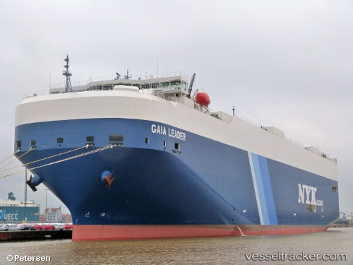
Vessel GAIA LEADER IMO: 9536818, MMSI: 431637000 Vehicles Carrier
UTC, 40.80491, 27.90625, course: 264, speed: 14.5
UTC, 40.74383, 27.54986, course: 245, speed: 14.4
2026-02-28 00:06:21 UTC, 40.46500, 26.83333, course: -1, speed: 14
Live AIS position:
UTC. Near Gelibolu),
updated 2026-02-28 00:06:21 UTC.
Find the position of the vessel GAIA LEADER on the map. The latter are known coordinates and path.
marine traffic ship tracker show on live map
The current position of vessel GAIA LEADER is 40.46500 lat / 26.83333 lng. Updated: 2026-02-28 00:06:21 UTCCurrently sailing under the flag of Japan
GAIA LEADER built in 2011 year
Deadweight:
21286 tDetails:
Last coordinates of the vessel:
UTC, 40.77574, 28.71610, course: 274, speed: 16.9UTC, 40.80491, 27.90625, course: 264, speed: 14.5
UTC, 40.74383, 27.54986, course: 245, speed: 14.4
2026-02-28 00:06:21 UTC, 40.46500, 26.83333, course: -1, speed: 14