 vesseltracker.com
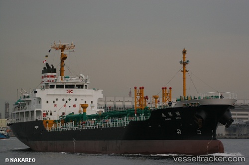
Vessel Shoho Maru IMO: 9330173, MMSI: 431800677 Chemical Oil Products Tanker
UTC, 41.85385, 141.69675, course: 183, speed: 14.3
UTC, 41.12025, 141.74323, course: 170, speed: 15
2026-02-09 21:22:10 UTC, 40.87840, 141.80487, course: 168, speed: 14.7
Live AIS position:
UTC. 24 nm NE of Hachinohe),
updated 2026-02-09 21:22:10 UTC.
Find the position of the vessel Shoho Maru on the map. The latter are known coordinates and path.
marine traffic ship tracker show on live map
The current position of vessel Shoho Maru is 40.87840 lat / 141.80487 lng. Updated: 2026-02-09 21:22:10 UTCCurrently sailing under the flag of Japan
Shoho Maru built in 2004 year
Deadweight:
4999 tDetails:
Last coordinates of the vessel:
UTC, 42.15678, 142.11292, course: 292, speed: 13.5UTC, 41.85385, 141.69675, course: 183, speed: 14.3
UTC, 41.12025, 141.74323, course: 170, speed: 15
2026-02-09 21:22:10 UTC, 40.87840, 141.80487, course: 168, speed: 14.7