 vesseltracker.com
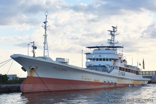
Vessel No83inarimaru IMO: 9156747, MMSI: 431903000 Fishing Vessel
UTC, 34.86500, 138.32666, course: -1, speed: 0
UTC, 34.86500, 138.32666, course: -1, speed: 0
UTC, 34.86500, 138.32666, course: -1, speed: 0
UTC, 34.86500, 138.32666, course: -1, speed: 0
2026-02-28 06:20:10 UTC, 34.86500, 138.32666, course: -1, speed: 0
Live Vessel No83inarimaru Analytics (details, animations, etc.)
Live AIS position: UTC. Near YAIZU), updated 2026-02-28 06:20:10 UTC.Find the position of the vessel No83inarimaru on the map. The latter are known coordinates and path.
marine traffic ship tracker show on live map
The current position of vessel No83inarimaru is 34.86500 lat / 138.32666 lng. Updated: 2026-02-28 06:20:10 UTCDetails:
Last coordinates of the vessel:
UTC, 34.86500, 138.32666, course: -1, speed: 0UTC, 34.86500, 138.32666, course: -1, speed: 0
UTC, 34.86500, 138.32666, course: -1, speed: 0
UTC, 34.86500, 138.32666, course: -1, speed: 0
UTC, 34.86500, 138.32666, course: -1, speed: 0
2026-02-28 06:20:10 UTC, 34.86500, 138.32666, course: -1, speed: 0