 vesseltracker.com
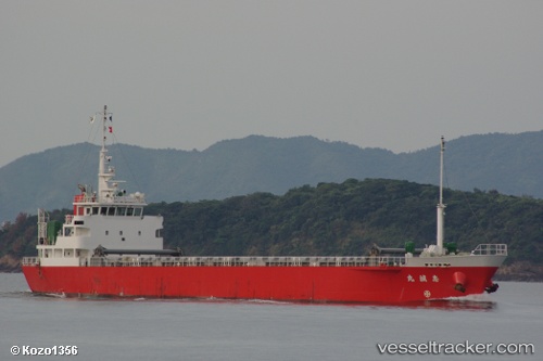
Vessel BLUE OCEAN HO IMO: 9596404, MMSI: 440201420 General Cargo
UTC, 35.07726, 128.81386, course: 90, speed: 0
UTC, 35.07724, 128.81384, course: 90, speed: 0
2026-03-19 11:35:58 UTC, 34.98323, 128.87904, course: 81, speed: 10.7
Live Vessel BLUE OCEAN HO Analytics (details, animations, etc.)
Live AIS position: UTC. Near BUSAN NEW PORT), updated 2026-03-19 11:35:58 UTC.Find the position of the vessel BLUE OCEAN HO on the map. The latter are known coordinates and path.
marine traffic ship tracker show on live map
The current position of vessel BLUE OCEAN HO is 34.98323 lat / 128.87904 lng. Updated: 2026-03-19 11:35:58 UTCCurrently sailing under the flag of South Korea
Details:
Last coordinates of the vessel:
UTC, 35.07702, 128.78793, course: -1, speed: 0.2UTC, 35.07726, 128.81386, course: 90, speed: 0
UTC, 35.07724, 128.81384, course: 90, speed: 0
2026-03-19 11:35:58 UTC, 34.98323, 128.87904, course: 81, speed: 10.7