 vesseltracker.com
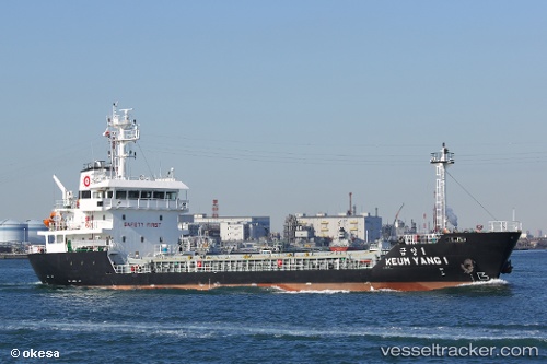
Vessel Keum Yang 1 IMO: 9793301, MMSI: 440710000 General Cargo Ship
UTC, 34.05692, 132.80969, course: -1, speed: 8.6
UTC, 34.09632, 133.03722, course: 68, speed: 9.4
2026-02-27 08:14:59 UTC, 34.26667, 133.49500, course: -1, speed: 9
Live AIS position:
UTC. 10 nm S of FUKUYAMA),
updated 2026-02-27 08:14:59 UTC.
Find the position of the vessel Keum Yang 1 on the map. The latter are known coordinates and path.
marine traffic ship tracker show on live map
The current position of vessel Keum Yang 1 is 34.26667 lat / 133.49500 lng. Updated: 2026-02-27 08:14:59 UTCDetails:
Last coordinates of the vessel:
UTC, 33.91833, 132.65334, course: -1, speed: 8UTC, 34.05692, 132.80969, course: -1, speed: 8.6
UTC, 34.09632, 133.03722, course: 68, speed: 9.4
2026-02-27 08:14:59 UTC, 34.26667, 133.49500, course: -1, speed: 9