 vesseltracker.com
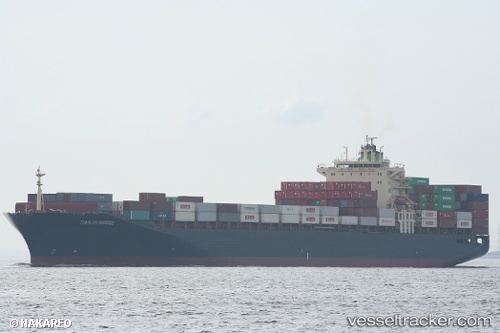
Vessel TIANJIN BRIDGE IMO: 9282962, MMSI: 440791000 Cargo
UTC, 13.36070, 110.46537, course: 187, speed: 16.7
UTC, 13.36070, 110.46537, course: 187, speed: 16.7
2026-02-26 15:42:43 UTC, 13.36070, 110.46537, course: 187, speed: 16.7
Live AIS position:
UTC. 44 nm SE of Tan Cang Qui Nhon),
updated 2026-02-26 15:42:43 UTC.
Find the position of the vessel TIANJIN BRIDGE on the map. The latter are known coordinates and path.
marine traffic ship tracker show on live map
The current position of vessel TIANJIN BRIDGE is 13.36070 lat / 110.46537 lng. Updated: 2026-02-26 15:42:43 UTCCurrently sailing under the flag of South Korea
Details:
Last coordinates of the vessel:
UTC, 13.47678, 110.48651, course: 189, speed: 16.6UTC, 13.36070, 110.46537, course: 187, speed: 16.7
UTC, 13.36070, 110.46537, course: 187, speed: 16.7
2026-02-26 15:42:43 UTC, 13.36070, 110.46537, course: 187, speed: 16.7