 vesseltracker.com
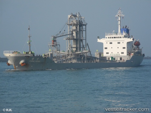
Vessel Chang Yahng IMO: 9121027, MMSI: 441077000 Cement Carrier
UTC, 37.49159, 129.13466, course: -1, speed: 0
UTC, 37.49161, 129.13464, course: -1, speed: 0
2026-01-16 18:43:35 UTC, 37.49161, 129.13463, course: -1, speed: 0
Live AIS position:
UTC. Near DONGHAE),
updated 2026-01-16 18:43:35 UTC.
Find the position of the vessel Chang Yahng on the map. The latter are known coordinates and path.
marine traffic ship tracker show on live map
The current position of vessel Chang Yahng is 37.49161 lat / 129.13463 lng. Updated: 2026-01-16 18:43:35 UTCCurrently sailing under the flag of Korea
Chang Yahng built in 1996 year
Deadweight:
10562 tDetails:
Last coordinates of the vessel:
UTC, 37.49159, 129.13461, course: -1, speed: 0UTC, 37.49159, 129.13466, course: -1, speed: 0
UTC, 37.49161, 129.13464, course: -1, speed: 0
2026-01-16 18:43:35 UTC, 37.49161, 129.13463, course: -1, speed: 0