 vesseltracker.com
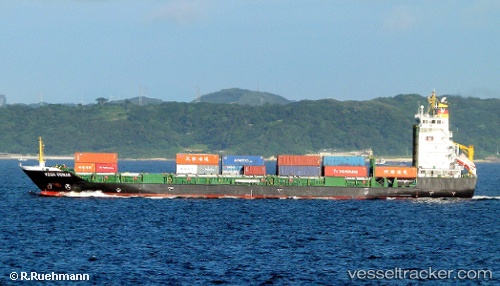
Vessel A KEIGA IMO: 9385453, MMSI: 477630400 Container Ship
UTC, 24.50673, 118.07553, course: 34, speed: 0.2
UTC, 24.50681, 118.07597, course: 29, speed: 0
2026-03-24 14:19:56 UTC, 24.50678, 118.07587, course: 29, speed: 0
Live Vessel A KEIGA Analytics (details, animations, etc.)
Live AIS position: UTC. Near Hsia-Men), updated 2026-03-24 14:19:56 UTC.Find the position of the vessel A KEIGA on the map. The latter are known coordinates and path.
marine traffic ship tracker show on live map
The current position of vessel A KEIGA is 24.50678 lat / 118.07587 lng. Updated: 2026-03-24 14:19:56 UTCCurrently sailing under the flag of Hong Kong, China
A KEIGA built in 2008 year
Deadweight:
8279 tDetails:
Last coordinates of the vessel:
UTC, 24.36511, 118.14339, course: 306, speed: 9.3UTC, 24.50673, 118.07553, course: 34, speed: 0.2
UTC, 24.50681, 118.07597, course: 29, speed: 0
2026-03-24 14:19:56 UTC, 24.50678, 118.07587, course: 29, speed: 0