 vesseltracker.com
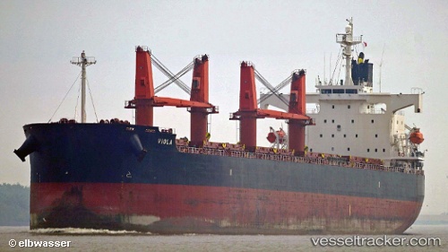
Vessel JIN RONG IMO: 9403061, MMSI: 477732600 Bulk Carrier
UTC, 25.35718, 56.59025, course: -1, speed: 0
UTC, 25.35718, 56.59025, course: -1, speed: 0
2026-03-20 17:11:13 UTC, 25.35718, 56.59025, course: -1, speed: 0
Live Vessel JIN RONG Analytics (details, animations, etc.)
Live AIS position: UTC. Near Offshore Fujairah), updated 2026-03-20 17:11:13 UTC.Find the position of the vessel JIN RONG on the map. The latter are known coordinates and path.
marine traffic ship tracker show on live map
The current position of vessel JIN RONG is 25.35718 lat / 56.59025 lng. Updated: 2026-03-20 17:11:13 UTCCurrently sailing under the flag of Hong Kong, China
JIN RONG built in 2008 year
Deadweight:
58729 tDetails:
Last coordinates of the vessel:
UTC, 25.35694, 56.59030, course: 127, speed: 0UTC, 25.35718, 56.59025, course: -1, speed: 0
UTC, 25.35718, 56.59025, course: -1, speed: 0
2026-03-20 17:11:13 UTC, 25.35718, 56.59025, course: -1, speed: 0