 vesseltracker.com
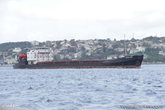
Vessel RIVER RAIN IMO: 8865949, MMSI: 511101328 General Cargo
UTC, 44.58232, 38.10949, course: 92, speed: 28.1
UTC, 44.58232, 38.10949, course: 92, speed: 28.1
2026-02-26 07:22:55 UTC, 44.46596, 37.52415, course: -1, speed: 0.5
Live AIS position:
UTC. 13 nm SW of Cpc Terminal),
updated 2026-02-26 07:22:55 UTC.
Find the position of the vessel RIVER RAIN on the map. The latter are known coordinates and path.
marine traffic ship tracker show on live map
The current position of vessel RIVER RAIN is 44.46596 lat / 37.52415 lng. Updated: 2026-02-26 07:22:55 UTCCurrently sailing under the flag of Palau
Details:
Last coordinates of the vessel:
UTC, 44.58331, 38.10909, course: -1, speed: 1UTC, 44.58232, 38.10949, course: 92, speed: 28.1
UTC, 44.58232, 38.10949, course: 92, speed: 28.1
2026-02-26 07:22:55 UTC, 44.46596, 37.52415, course: -1, speed: 0.5