 vesseltracker.com
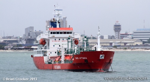
Vessel Gas Attaka IMO: 9629433, MMSI: 525008076 Lpg Tanker
UTC, -0.65667, 119.80833, course: -1, speed: 0
UTC, -0.65667, 119.80833, course: -1, speed: 0
2026-02-25 06:43:21 UTC, -0.65667, 119.80833, course: -1, speed: 0
Live AIS position:
UTC. 14 nm N of Palu),
updated 2026-02-25 06:43:21 UTC.
Find the position of the vessel Gas Attaka on the map. The latter are known coordinates and path.
marine traffic ship tracker show on live map
The current position of vessel Gas Attaka is -0.65667 lat / 119.80833 lng. Updated: 2026-02-25 06:43:21 UTCDetails:
Last coordinates of the vessel:
UTC, -0.65667, 119.80833, course: -1, speed: 0UTC, -0.65667, 119.80833, course: -1, speed: 0
UTC, -0.65667, 119.80833, course: -1, speed: 0
2026-02-25 06:43:21 UTC, -0.65667, 119.80833, course: -1, speed: 0