 vesseltracker.com
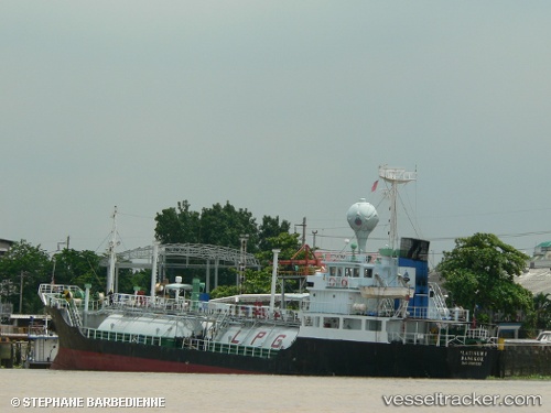
Vessel ZAKARIA 5 IMO: 8921535, MMSI: 525018091 LPG Tanker
Live AIS position:
UTC. 16 nm N of TANJUNG JATI),
updated 2025-03-25 14:56:43 UTC.
Find the position of the vessel ZAKARIA 5 on the map. The latter are known coordinates and path.
marine traffic ship tracker show on live map
The current position of vessel ZAKARIA 5 is -6.17758 lat / 110.77116 lng. Updated: 2025-03-25 14:56:43 UTCCurrently sailing under the flag of Indonesia
ZAKARIA 5 built in 1990 year
Deadweight:
951 tDetails:
Last coordinates of the vessel:
2025-03-25 14:56:43 UTC, -6.17758, 110.77116, course: -1, speed: 5