 vesseltracker.com
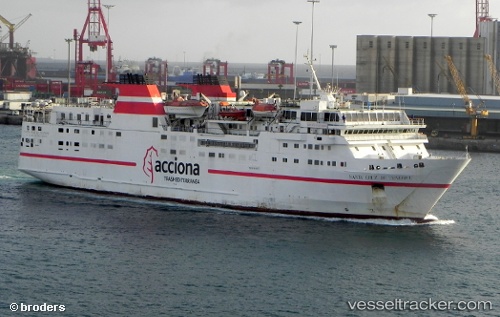
Vessel Seira IMO: 9032006, MMSI: 525100633 Passenger Ro Ro Cargo Ship
UTC, -5.81962, 105.80342, course: -1, speed: 0.4
UTC, -5.81965, 105.80332, course: -1, speed: 0.1
2026-03-05 21:29:57 UTC, -5.81993, 105.80297, course: -1, speed: 0.2
Live Vessel Seira Analytics (details, animations, etc.)
Live AIS position: UTC. Near BAKAUHENI), updated 2026-03-05 21:29:57 UTC.Find the position of the vessel Seira on the map. The latter are known coordinates and path.
marine traffic ship tracker show on live map
The current position of vessel Seira is -5.81993 lat / 105.80297 lng. Updated: 2026-03-05 21:29:57 UTCCurrently sailing under the flag of Indonesia
Seira built in 1994 year
Deadweight:
2706 tDetails:
Last coordinates of the vessel:
UTC, -5.82036, 105.80369, course: -1, speed: 0.3UTC, -5.81962, 105.80342, course: -1, speed: 0.4
UTC, -5.81965, 105.80332, course: -1, speed: 0.1
2026-03-05 21:29:57 UTC, -5.81993, 105.80297, course: -1, speed: 0.2