 vesseltracker.com
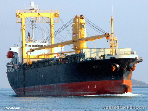
MV. SINAR KUDUS 88
Current StatusLive Vessel MV. SINAR KUDUS 88 Analytics (details, animations, etc.)
Latest AIS update:
Current position: 5.14123° S, 119.36846° E (Near Makassar)
This page shows the vessel’s latest location, recent movement, and operational context from ShipInfo and TOPOS data.
Open the map below to view live position, track history, probable destinations, and nearby traffic.
The current position of vessel MV. SINAR KUDUS 88 is -5.14123 lat / 119.36846 lng. Updated: 2026-03-25 01:26:06 UTCNearest reference points:
- Near Makassar
- Near Panakukang
- 12 nm W of Panakukang
Currently sailing under the flag of Indonesia
Details:
Last coordinates of the vessel:
2026-03-24 20:49:02 UTC, -5.13943, 119.36829, course: -1, speed: 0.12026-03-25 01:26:06 UTC, -5.14123, 119.36846, course: -1, speed: 0
2026-03-25 01:26:06 UTC, -5.14123, 119.36846, course: -1, speed: 0
2026-03-25 01:26:06 UTC, -5.14123, 119.36846, course: -1, speed: 0