 vesseltracker.com
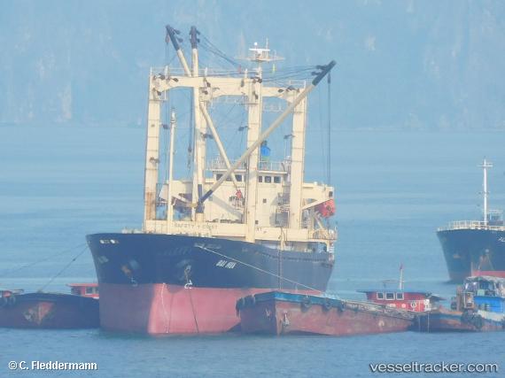
Vessel MV.SAHABAT SENTOSA IMO: 9204336, MMSI: 525601784 General Cargo
UTC, -1.03345, 100.36149, course: -1, speed: 0.4
UTC, -1.03384, 100.36046, course: -1, speed: 0.2
2026-03-24 18:00:07 UTC, -1.03388, 100.36038, course: -1, speed: 0.1
Live Vessel MV.SAHABAT SENTOSA Analytics (details, animations, etc.)
Live AIS position: UTC. Near Padang), updated 2026-03-24 18:00:07 UTC.Find the position of the vessel MV.SAHABAT SENTOSA on the map. The latter are known coordinates and path.
marine traffic ship tracker show on live map
The current position of vessel MV.SAHABAT SENTOSA is -1.03388 lat / 100.36038 lng. Updated: 2026-03-24 18:00:07 UTCCurrently sailing under the flag of Indonesia
Details:
Last coordinates of the vessel:
UTC, -1.03367, 100.36178, course: -1, speed: 0.1UTC, -1.03345, 100.36149, course: -1, speed: 0.4
UTC, -1.03384, 100.36046, course: -1, speed: 0.2
2026-03-24 18:00:07 UTC, -1.03388, 100.36038, course: -1, speed: 0.1