 vesseltracker.com
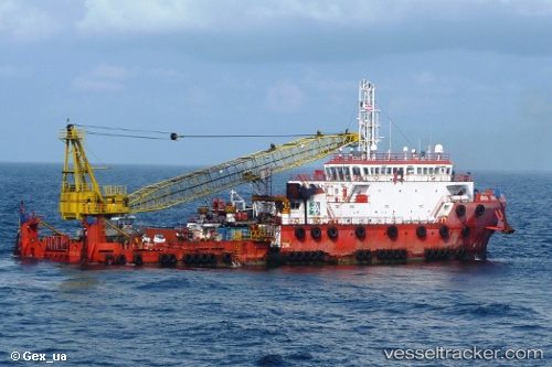
Vessel Armada Firman 2 IMO: 9411240, MMSI: 533003510 Offshore Support Vessel
UTC, 7.78667, 102.49833, course: -1, speed: 0
UTC, 7.78667, 102.50167, course: -1, speed: 0
2026-02-26 15:09:45 UTC, 7.78667, 102.50167, course: -1, speed: 0
Live AIS position:
UTC. 31 nm NW of Muda Marine Terminal),
updated 2026-02-26 15:09:45 UTC.
Find the position of the vessel Armada Firman 2 on the map. The latter are known coordinates and path.
marine traffic ship tracker show on live map
The current position of vessel Armada Firman 2 is 7.78667 lat / 102.50167 lng. Updated: 2026-02-26 15:09:45 UTCDetails:
Last coordinates of the vessel:
UTC, 7.78833, 102.49500, course: -1, speed: 0UTC, 7.78667, 102.49833, course: -1, speed: 0
UTC, 7.78667, 102.50167, course: -1, speed: 0
2026-02-26 15:09:45 UTC, 7.78667, 102.50167, course: -1, speed: 0