 vesseltracker.com
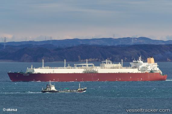
Vessel Al Gharrafa IMO: 9337717, MMSI: 538002920 Lng Tanker
UTC, 7.64846, -16.56162, course: 140, speed: 16.1
UTC, 7.28362, -16.28436, course: 141, speed: 16.4
2026-02-10 10:20:34 UTC, 6.71570, -15.85456, course: 141, speed: 16.5
Live AIS position:
UTC. 189 nm SW of NASSIT),
updated 2026-02-10 10:20:34 UTC.
Find the position of the vessel Al Gharrafa on the map. The latter are known coordinates and path.
marine traffic ship tracker show on live map
The current position of vessel Al Gharrafa is 6.71570 lat / -15.85456 lng. Updated: 2026-02-10 10:20:34 UTCCurrently sailing under the flag of Marshall Is
Al Gharrafa built in 2008 year
Deadweight:
106898 tDetails:
Last coordinates of the vessel:
UTC, 8.10018, -16.92024, course: 141, speed: 16.1UTC, 7.64846, -16.56162, course: 140, speed: 16.1
UTC, 7.28362, -16.28436, course: 141, speed: 16.4
2026-02-10 10:20:34 UTC, 6.71570, -15.85456, course: 141, speed: 16.5