 vesseltracker.com
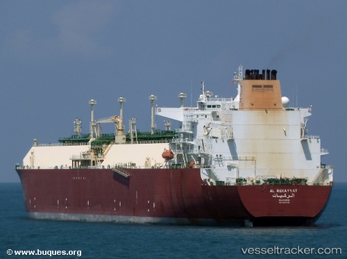
Vessel Al Rekayyat IMO: 9397339, MMSI: 538003347 Lng Tanker
UTC, 21.44705, 121.91975, course: 25, speed: 16.1
UTC, 21.85500, 122.09833, course: -1, speed: 17
2026-02-10 23:23:59 UTC, 22.24833, 122.19500, course: -1, speed: 8
Live AIS position:
UTC. 106 nm E of Kaohsiung),
updated 2026-02-10 23:23:59 UTC.
Find the position of the vessel Al Rekayyat on the map. The latter are known coordinates and path.
marine traffic ship tracker show on live map
The current position of vessel Al Rekayyat is 22.24833 lat / 122.19500 lng. Updated: 2026-02-10 23:23:59 UTCDetails:
Last coordinates of the vessel:
UTC, 20.84833, 121.45833, course: -1, speed: 16UTC, 21.44705, 121.91975, course: 25, speed: 16.1
UTC, 21.85500, 122.09833, course: -1, speed: 17
2026-02-10 23:23:59 UTC, 22.24833, 122.19500, course: -1, speed: 8