 vesseltracker.com
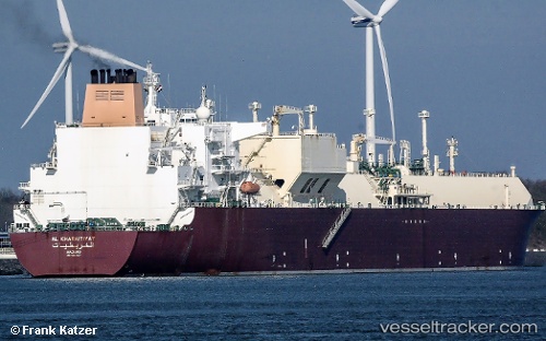
Vessel Al Kharaitiyat IMO: 9397327, MMSI: 538003352 Lng Tanker
UTC, 25.93742, 51.61353, course: -1, speed: 0
UTC, 25.92323, 51.65384, course: 98, speed: 9.4
2026-03-02 07:46:16 UTC, 25.80701, 51.85571, course: -1, speed: 0.3
Live AIS position:
UTC. 14 nm SE of RAS LAFFAN),
updated 2026-03-02 07:46:16 UTC.
Find the position of the vessel Al Kharaitiyat on the map. The latter are known coordinates and path.
marine traffic ship tracker show on live map
The current position of vessel Al Kharaitiyat is 25.80701 lat / 51.85571 lng. Updated: 2026-03-02 07:46:16 UTCCurrently sailing under the flag of Marshall Is
Al Kharaitiyat built in 2009 year
Deadweight:
107153 tDetails:
Last coordinates of the vessel:
UTC, 25.93740, 51.61355, course: 138, speed: 0.5UTC, 25.93742, 51.61353, course: -1, speed: 0
UTC, 25.92323, 51.65384, course: 98, speed: 9.4
2026-03-02 07:46:16 UTC, 25.80701, 51.85571, course: -1, speed: 0.3