 vesseltracker.com
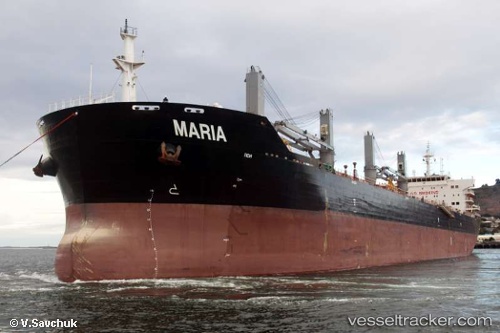
Vessel Maria IMO: 9519016, MMSI: 538003561 Bulk Carrier
UTC, -26.75278, 45.23992, course: 64, speed: 8.1
UTC, -26.74641, 45.25352, course: 64, speed: 7.9
2026-01-14 15:33:51 UTC, -26.68698, 45.38908, course: 70, speed: 7.5
Live AIS position:
UTC. 83 nm S of Tsiombe),
updated 2026-01-14 15:33:51 UTC.
Find the position of the vessel Maria on the map. The latter are known coordinates and path.
marine traffic ship tracker show on live map
The current position of vessel Maria is -26.68698 lat / 45.38908 lng. Updated: 2026-01-14 15:33:51 UTCDetails:
Last coordinates of the vessel:
UTC, -26.85365, 45.00810, course: 65, speed: 8.3UTC, -26.75278, 45.23992, course: 64, speed: 8.1
UTC, -26.74641, 45.25352, course: 64, speed: 7.9
2026-01-14 15:33:51 UTC, -26.68698, 45.38908, course: 70, speed: 7.5