 vesseltracker.com
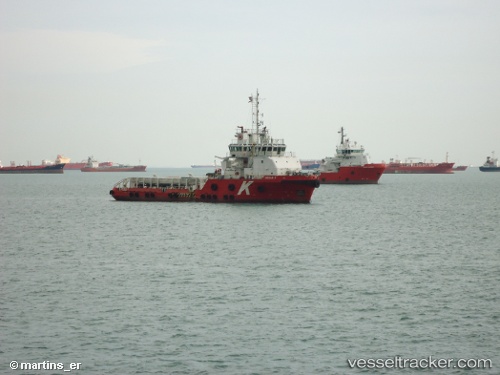
Vessel Cecilie K IMO: 9444156, MMSI: 538003588 Offshore Tug Supply Ship
UTC, 26.66567, 50.25849, course: 338, speed: 0.5
UTC, 26.66551, 50.25820, course: 347, speed: 0.7
2026-03-02 23:37:26 UTC, 26.66556, 50.25800, course: 350, speed: 0.4
Live AIS position:
UTC. Near Ras Tannurah),
updated 2026-03-02 23:37:26 UTC.
Find the position of the vessel Cecilie K on the map. The latter are known coordinates and path.
marine traffic ship tracker show on live map
The current position of vessel Cecilie K is 26.66556 lat / 50.25800 lng. Updated: 2026-03-02 23:37:26 UTCCurrently sailing under the flag of Marshall Is
Cecilie K built in 2010 year
Deadweight:
1686 tDetails:
Last coordinates of the vessel:
UTC, 26.66566, 50.25839, course: -1, speed: 0.3UTC, 26.66567, 50.25849, course: 338, speed: 0.5
UTC, 26.66551, 50.25820, course: 347, speed: 0.7
2026-03-02 23:37:26 UTC, 26.66556, 50.25800, course: 350, speed: 0.4