 vesseltracker.com
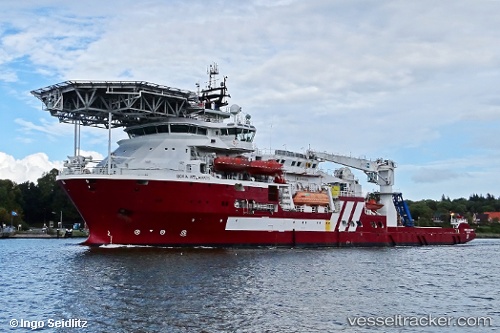
Vessel Boka Atlantis IMO: 9441221, MMSI: 538003646 Offshore Support Vessel
UTC, 57.13394, -2.05849, course: 181, speed: 0
UTC, 57.13393, -2.05855, course: 181, speed: 0
2026-03-24 11:30:25 UTC, 57.13397, -2.05849, course: 181, speed: 0
Live Vessel Boka Atlantis Analytics (details, animations, etc.)
Live AIS position: UTC. Near Aberdeen), updated 2026-03-24 11:30:25 UTC.Find the position of the vessel Boka Atlantis on the map. The latter are known coordinates and path.
marine traffic ship tracker show on live map
The current position of vessel Boka Atlantis is 57.13397 lat / -2.05849 lng. Updated: 2026-03-24 11:30:25 UTCCurrently sailing under the flag of Marshall Is
Boka Atlantis built in 2011 year
Deadweight:
5662 tDetails:
Last coordinates of the vessel:
UTC, 57.13397, -2.05853, course: 182, speed: 0UTC, 57.13394, -2.05849, course: 181, speed: 0
UTC, 57.13393, -2.05855, course: 181, speed: 0
2026-03-24 11:30:25 UTC, 57.13397, -2.05849, course: 181, speed: 0