 vesseltracker.com
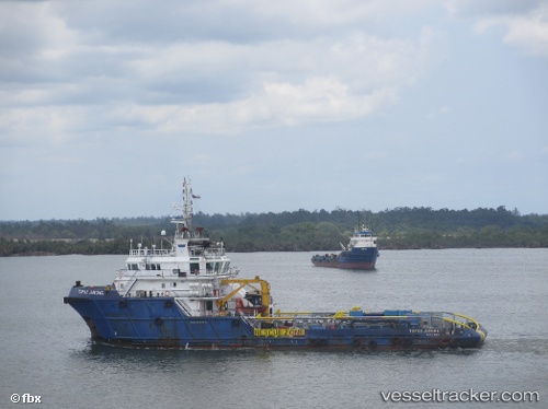
Vessel TOPAZ JURONG IMO: 9563811, MMSI: 538003838 Offshore Tug/Supply Ship
UTC, 25.86500, 51.65833, course: -1, speed: 0
UTC, 25.86655, 51.65980, course: -1, speed: 0.6
2026-03-25 01:36:35 UTC, 25.86579, 51.65931, course: -1, speed: 0.1
Live Vessel TOPAZ JURONG Analytics (details, animations, etc.)
Live AIS position: UTC. Near RAS LAFFAN), updated 2026-03-25 01:36:35 UTC.Find the position of the vessel TOPAZ JURONG on the map. The latter are known coordinates and path.
marine traffic ship tracker show on live map
The current position of vessel TOPAZ JURONG is 25.86579 lat / 51.65931 lng. Updated: 2026-03-25 01:36:35 UTCCurrently sailing under the flag of Marshall Islands
TOPAZ JURONG built in 2010 year
Deadweight:
1374 tDetails:
Last coordinates of the vessel:
UTC, 25.86592, 51.65973, course: -1, speed: 0.1UTC, 25.86500, 51.65833, course: -1, speed: 0
UTC, 25.86655, 51.65980, course: -1, speed: 0.6
2026-03-25 01:36:35 UTC, 25.86579, 51.65931, course: -1, speed: 0.1