 vesseltracker.com
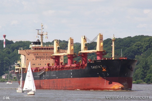
Vessel Tanta T IMO: 9497086, MMSI: 538004100 Bulk Carrier
UTC, 36.13581, -5.41409, course: -1, speed: 0.1
UTC, 36.13488, -5.41380, course: 58, speed: 0.1
2026-03-24 23:53:35 UTC, 36.13574, -5.41429, course: 83, speed: 0.1
Live Vessel Tanta T Analytics (details, animations, etc.)
Live AIS position: UTC. Near Algeciras), updated 2026-03-24 23:53:35 UTC.Find the position of the vessel Tanta T on the map. The latter are known coordinates and path.
marine traffic ship tracker show on live map
The current position of vessel Tanta T is 36.13574 lat / -5.41429 lng. Updated: 2026-03-24 23:53:35 UTCCurrently sailing under the flag of Marshall Is
Tanta T built in 2011 year
Deadweight:
32500 tDetails:
Last coordinates of the vessel:
UTC, 36.13790, -5.41287, course: 127, speed: 0.1UTC, 36.13581, -5.41409, course: -1, speed: 0.1
UTC, 36.13488, -5.41380, course: 58, speed: 0.1
2026-03-24 23:53:35 UTC, 36.13574, -5.41429, course: 83, speed: 0.1