 vesseltracker.com
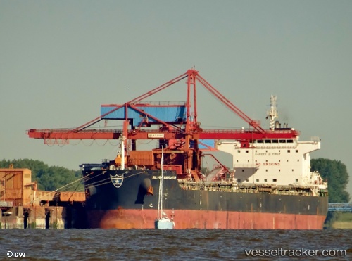
Vessel THEOTOKOS S IMO: 9613769, MMSI: 538004305 Bulk Carrier
UTC, 21.06500, 37.59500, course: -1, speed: 10
UTC, 20.61722, 37.64370, course: 181, speed: 9.8
2026-03-19 07:27:04 UTC, 20.42875, 37.65959, course: 178, speed: 10.1
Live Vessel THEOTOKOS S Analytics (details, animations, etc.)
Live AIS position: UTC. 54 nm NE of Port Sudan), updated 2026-03-19 07:27:04 UTC.Find the position of the vessel THEOTOKOS S on the map. The latter are known coordinates and path.
marine traffic ship tracker show on live map
The current position of vessel THEOTOKOS S is 20.42875 lat / 37.65959 lng. Updated: 2026-03-19 07:27:04 UTCCurrently sailing under the flag of MARSHALL ISLANDS
Details:
Last coordinates of the vessel:
UTC, 21.39084, 37.56195, course: 177, speed: 9.6UTC, 21.06500, 37.59500, course: -1, speed: 10
UTC, 20.61722, 37.64370, course: 181, speed: 9.8
2026-03-19 07:27:04 UTC, 20.42875, 37.65959, course: 178, speed: 10.1