 vesseltracker.com
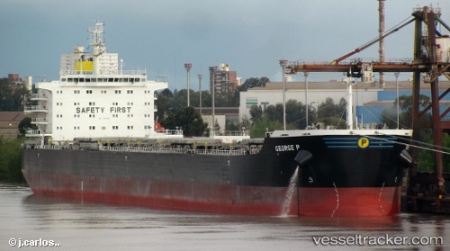
Vessel George P IMO: 9609160, MMSI: 538004413 Bulk Carrier
UTC, 11.22133, 71.89833, course: 229, speed: 10.6
UTC, 11.22133, 71.89833, course: 229, speed: 10.6
2026-03-02 09:22:38 UTC, 10.76600, 71.32200, course: -1, speed: 10.5
Live AIS position:
UTC. 86 nm W of Amini Island),
updated 2026-03-02 09:22:38 UTC.
Find the position of the vessel George P on the map. The latter are known coordinates and path.
marine traffic ship tracker show on live map
The current position of vessel George P is 10.76600 lat / 71.32200 lng. Updated: 2026-03-02 09:22:38 UTCCurrently sailing under the flag of Marshall Is
George P built in 2012 year
Deadweight:
81569 tDetails:
Last coordinates of the vessel:
UTC, 11.63417, 72.47533, course: -1, speed: 10.6UTC, 11.22133, 71.89833, course: 229, speed: 10.6
UTC, 11.22133, 71.89833, course: 229, speed: 10.6
2026-03-02 09:22:38 UTC, 10.76600, 71.32200, course: -1, speed: 10.5