 vesseltracker.com
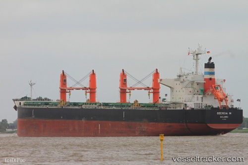
Vessel Georgia M IMO: 9616618, MMSI: 538004498 Bulk Carrier
UTC, 26.60341, 50.29141, course: 128, speed: 0
UTC, 26.60369, 50.29147, course: 135, speed: 0
2026-02-11 07:52:33 UTC, 26.60352, 50.29116, course: 128, speed: 0
Live AIS position:
UTC. Near Ad Dammam),
updated 2026-02-11 07:52:33 UTC.
Find the position of the vessel Georgia M on the map. The latter are known coordinates and path.
marine traffic ship tracker show on live map
The current position of vessel Georgia M is 26.60352 lat / 50.29116 lng. Updated: 2026-02-11 07:52:33 UTCCurrently sailing under the flag of Marshall Is
Georgia M built in 2012 year
Deadweight:
58666 tDetails:
Last coordinates of the vessel:
UTC, 26.60379, 50.29232, course: 156, speed: 0UTC, 26.60341, 50.29141, course: 128, speed: 0
UTC, 26.60369, 50.29147, course: 135, speed: 0
2026-02-11 07:52:33 UTC, 26.60352, 50.29116, course: 128, speed: 0