 vesseltracker.com
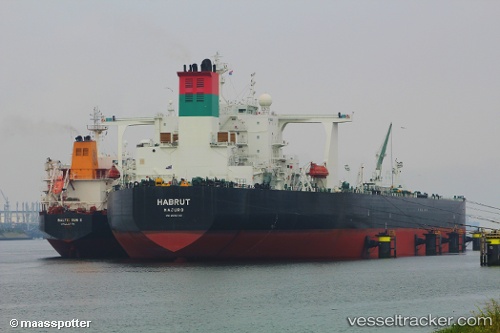
Vessel Habrut IMO: 9500730, MMSI: 538004577 Crude Oil Tanker
UTC, 25.62380, 53.63745, course: 228, speed: 1.3
UTC, 25.65036, 53.59859, course: 216, speed: 1.3
2026-03-25 03:35:15 UTC, 25.67870, 53.56242, course: 209, speed: 1.2
Live Vessel Habrut Analytics (details, animations, etc.)
Live AIS position: UTC. 13 nm N of Mirfa), updated 2026-03-25 03:35:15 UTC.Find the position of the vessel Habrut on the map. The latter are known coordinates and path.
marine traffic ship tracker show on live map
The current position of vessel Habrut is 25.67870 lat / 53.56242 lng. Updated: 2026-03-25 03:35:15 UTCCurrently sailing under the flag of Marshall Is
Habrut built in 2012 year
Deadweight:
319439 tDetails:
Last coordinates of the vessel:
UTC, 25.60519, 53.65870, course: 235, speed: 0.6UTC, 25.62380, 53.63745, course: 228, speed: 1.3
UTC, 25.65036, 53.59859, course: 216, speed: 1.3
2026-03-25 03:35:15 UTC, 25.67870, 53.56242, course: 209, speed: 1.2