 vesseltracker.com
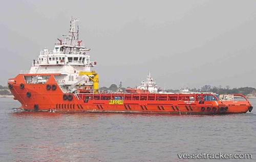
Vessel TOPAZ SOPHIE IMO: 9680657, MMSI: 538005335 Offshore Supply Ship
UTC, 26.13338, 51.67238, course: 10, speed: 4.8
UTC, 26.25587, 51.74834, course: 23, speed: 4.9
2026-02-27 14:35:48 UTC, 26.47600, 51.89164, course: 44, speed: 5.6
Live AIS position:
UTC. Near Al Shaheen terminal),
updated 2026-02-27 14:35:48 UTC.
Find the position of the vessel TOPAZ SOPHIE on the map. The latter are known coordinates and path.
marine traffic ship tracker show on live map
The current position of vessel TOPAZ SOPHIE is 26.47600 lat / 51.89164 lng. Updated: 2026-02-27 14:35:48 UTCCurrently sailing under the flag of Marshall Islands
TOPAZ SOPHIE built in 2013 year
Deadweight:
3130 tDetails:
Last coordinates of the vessel:
UTC, 25.95192, 51.66815, course: 3, speed: 5.1UTC, 26.13338, 51.67238, course: 10, speed: 4.8
UTC, 26.25587, 51.74834, course: 23, speed: 4.9
2026-02-27 14:35:48 UTC, 26.47600, 51.89164, course: 44, speed: 5.6