 vesseltracker.com
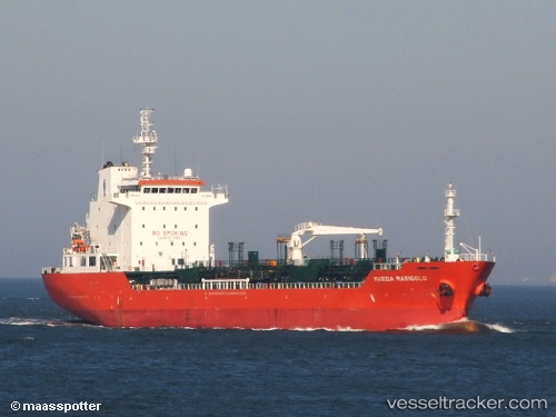
Vessel River Oak IMO: 9438157, MMSI: 538005559 Chemical Oil Products Tanker
UTC, -22.88577, 14.46103, course: 167, speed: 0
UTC, -22.88575, 14.46113, course: 175, speed: 0
2026-03-15 19:45:29 UTC, -22.88563, 14.46143, course: 188, speed: 0
Live Vessel River Oak Analytics (details, animations, etc.)
Live AIS position: UTC. Near WALVIS BAY), updated 2026-03-15 19:45:29 UTC.Find the position of the vessel River Oak on the map. The latter are known coordinates and path.
marine traffic ship tracker show on live map
The current position of vessel River Oak is -22.88563 lat / 14.46143 lng. Updated: 2026-03-15 19:45:29 UTCDetails:
Last coordinates of the vessel:
UTC, -22.88588, 14.46188, course: 214, speed: 0UTC, -22.88577, 14.46103, course: 167, speed: 0
UTC, -22.88575, 14.46113, course: 175, speed: 0
2026-03-15 19:45:29 UTC, -22.88563, 14.46143, course: 188, speed: 0